Discover the Force! Sethian College

Get the big picture: opefs.com

EARTH NAVIGATION: 0 - 0 of 19
MOON
GCP
TSUNAMI
click to zoom
Wednesday, 18. October, 2006
Possible lunar causal influence on Hawaiian earthquake and
Kilauea eruption on 15.Oct 2006
by Erich Habich, opefs.com

During the Hawaiian earthquake magnitude 6.7 on Sunday, 15.Oct. 2006, the Moon was seen passing over the area of Hawaii. The earthquake was the strongest in two decades. On these maps and movies the moon image represents the "sublunar point", which is the area where the Moon exerts the greatest gravitational force on Earth: (ref.
http://tidesandcurrents.noaa.gov/restles3.html)

Sublunar point
The following sequence of images illustrates the possible effect of the Moons gravity on seismic activity in Hawaii on 15.Oct. 2006:


16:48 UTC


17:08 UTC


17:27 UTC

17:47 UTC

18:07 UTC

18:27 UTC

The times are accurate to within 10 minutes.
Download movie of the Hawaiian earthquake and lunar pass

My take on this is that chaos theory tells us that tiny causes can have huge effects, such as butterflies flapping wings in the Himalayas can cause a hurricane on the other side of the world. Why shouldn't the moon then influence (cause) a quake on Earth, especially when it stands precisely over the spot where a magma chamber is weakened to the point of bursting anyways?

The strictly scientific view that earthquakes should then always happen more often in places over which the moon passes would be a simple mechanistic one, without taking into account chaos theory.

References:

Pro & contra lunar influences: National Geographic
Pro lunar influences: Pulse of the Planet Audio Presentation (NatGeo)
Contra lunar influence: Centre for Astrophysics and Supercomputing, Australia

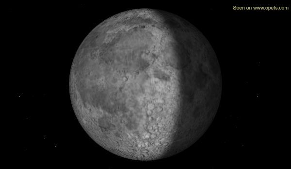
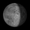
This picture shows the current phase of the Moon.

Moonphase
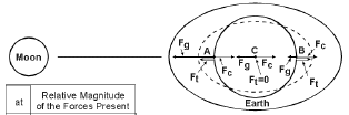
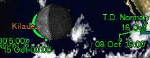
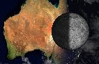
The wandering Moon image, which is present on most maps of this website, indicates the position of the Moons gravity center on Earth (sublunar point), otherwise known as "tide-producing center".

continue reading below


The picture below shows a view of the Earth from the vantage point of the Moon, the curent Earth phase:
Click on the picture for a larger view and an computer animation of the waxing and waning Earth:

The current Earth phase seen from the Moon

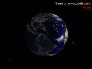
From this perspective it is possible to watch the progress of any solar eclipse as it progresses across the Earth. A bright yellow dot marks the position of the sun (viewable before and after each full moon).


Total lunar eclipse from 4th March 2007 over Europe:
here is a small movie from that event:
Lunar Eclipse 4.March.2007 download here.
(To see all details enlarge to full-screen).


dHere are several pictures of the current moonphase which you can use on your website. All pictures on this page can be linked to.


The pictures are updated every 3 hours.
d
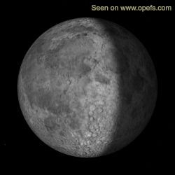
Use for example the URL's
http://www.ehabich.info/images/synchro/moon_100x100.jpeg

http://www.ehabich.info/images/synchro/moon_250x250.jpeg
http://www.ehabich.info/images/synchro/moon_splash.jpeg.


A great thanks goes to all the programmers and volunteers around the globe whose work makes this page possible, especially Hari Nair of http://xplanet.sourceforge.net/, Hans Ecke and Michael Dear. All rights acknowledged.
Internet Content Rating Association
Labelled with ICRA
Creative Commons License This work is licensed under a Creative Commons Attribution-NonCommercial-ShareAlike 2.0 Germany License.
"Our Planet Earth From Space" concept and code implementation - Copyright Erich Habich © 2003-2004.
The images on this website are offered under a Creative Commons Lizenz, the limitation being that you must not download the same image repeatedly in intervals of more often than once every 20 min. Questions ?: Click here to send me an email


http://opefs.com