|
Home
|
Impressum
|
||||||
|
|
|
||||||||||||||||
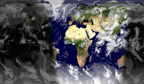
Click on the map to zoom in on the region... |
This website is cookie free. This website displays every 30 minutes the latest global warming info, clouds, fires, ships. You can also track the state of the Polar icecaps, day and night zones, the moonphase and more... This website uses "Blue Marble" images from NASA, to portray the changing seasons of the planet. Every month a different earth map is displayed, which shows the changing colors of the vegetation and changes in ice coverage globally. 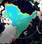 There is a movie sequence of the North Pole Sea Ice. You can watch how the Polar Ice melts in the summer, opening up the North West Passage. There is a movie sequence of the North Pole Sea Ice. You can watch how the Polar Ice melts in the summer, opening up the North West Passage. In the winter the open seas quickly freeze again, making shipping impossible, except for ice breakers. |
| A great thanks goes to all the programmers and volunteers around the globe whose work makes this page possible, especially Hari Nair of http://xplanet.sourceforge.net/, Hans Ecke and Michael Dear. All rights acknowledged. |  This
work is licensed under a Creative
Commons Attribution-NonCommercial-ShareAlike 2.0 Germany License.
"Our Planet Earth From Space" concept and code implementation
- Copyright Erich Habich-Traut © 2003-2016. Questions ?:
Click
here to send me an email This
work is licensed under a Creative
Commons Attribution-NonCommercial-ShareAlike 2.0 Germany License.
"Our Planet Earth From Space" concept and code implementation
- Copyright Erich Habich-Traut © 2003-2016. Questions ?:
Click
here to send me an email |